Entry Date: 13.11.2020, at 15:22:37 hrs (local)
Whangarei - Kaikoura

Whangarei Heads - Mt. Manaia
| PRID: | 12045 |
|---|---|
| LegID: | 326 |
| LegNo: | 74 |
| Latitude: | S035°47.64' |
| Longitude: | E174°29.45' |
| Day#: | 984 |
| Log (Day): | 10 nm |
| Log (Leg): | 10 nm |
| Log (Total): | 52011 nm |
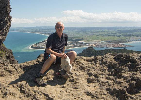
It is time to do some exercise. Mt. Manaia, the second tallest mountain of Whangarei Heads is the destination. A nice hiking trail with about 1100 steps goes up to the towering rock in 420 meters altitude. The view is stunning: the Pacific Ocean in the East, Whangerei Harbour in the West and Bream Bay with the Oil refinery and wood loading harbor in the South.
Mr. Manaia is the eroded left-over of a former 1000 m tall strata volcano. For the Maori it is a sacred place as they have buried their important chiefs up here.
There is ale a legend behind it: Mount Manaia is the ancestor and chief of the tribe Ngatiwai and many Iwi and sub-tribes of the Northland region. The craggy peaks represent his family who were turned to stone through ritual chants in a dispute over the infidelity of his wife.


